


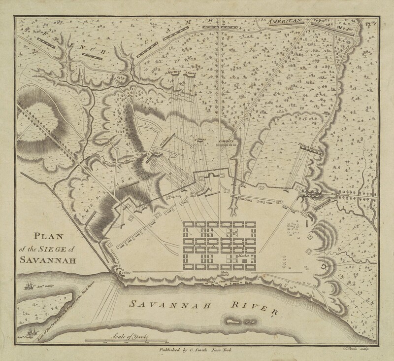
Plan of the Siege of Savannah
1796
Charles B. J. Févret de Saint-Mémin
Artist, French, 1770 - 1852
Artwork overview
-
Medium
engraving in black on laid paper mounted to brown wove paper
-
Credit Line
-
Dimensions
image: 21.11 × 23.34 cm (8 5/16 × 9 3/16 in.)
sheet: 23.18 × 25.4 cm (9 1/8 × 10 in.)
mount: 29.21 × 40.64 cm (11 1/2 × 16 in.) -
Accession Number
2015.19.1584.58.1
-
Catalogue Raisonné
Miles 1994, no. 985
Artwork history & notes
Provenance
the artist, Dijon, France; Léon Victor Raoul Leclerc, Vicomte de Juigné (the artist's nephew), Dijon, France, 1852; (Henry Stevens, London, England, c. 1859); William W. Corcoran, Washington, DC, c. 1874; Corcoran Gallery of Art, Washington, DC, 1875; acquired 2015 by the National Gallery of Art
Associated Names
Bibliography
1994
Miles, Ellen G. Saint-Mémin and the Neoclassical Profile Portrait in America. Washington, DC: National Portrait Gallery, 1994, p. 438, no. 985.
Inscriptions
upper right in plate: Pl. V; lower center in plate: Published by C. Smith New York; lower right in plate: St. Memin sculp.
Wikidata ID
Q77013826