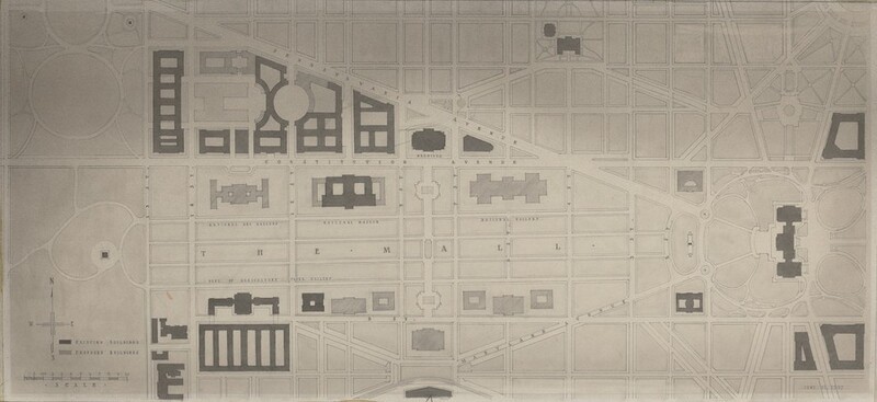
Plan of the Mall and Vicinity Showing Existing and Proposed Buildings

1937

John Russell Pope

Associated Names
John Russell Pope

Architect, American, 1874 - 1937

This is a drawing of a planned urban layout or city map. The detailed drawing presents a schematic of an urban area with streets, paths, and blocks indicated by lines and shapes. The map differentiates existing and proposed buildings using different shadings or patterns. A compass rose indicating directions and a scale for measurement are present in the lower left corner of the drawing. Labels are used for certain areas and structures such as galleries, museums, and specific routes like avenues. The map appears to be a historical cityscape plan likely used for planning or presentation purposes.
This object’s media is not available for download. Contact us about image usage.

Artwork overview

  • Medium

    pen and black ink and gray wash over graphite

  • Credit Line

    Acquired from Eggers and Higgins, Architects

  • Dimensions

    sight size: 30 x 66 cm (11 13/16 x 26 in.)

  • Accession Number

    1984.44.39

  • Series Title

    NGA West Building Drawings [1984.44.1-114; 1984.106.1]


Artwork history & notes

Wikidata ID

Q64583934

You may be interested in

Loading Results