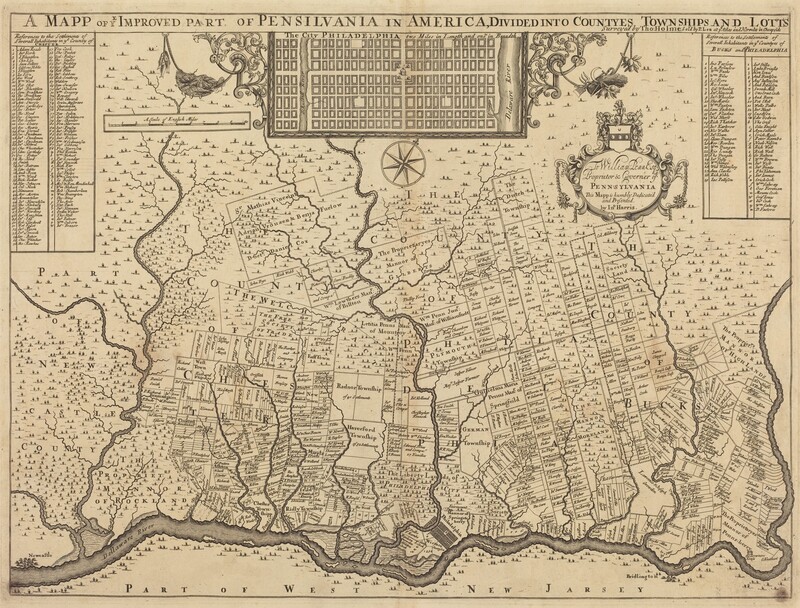
A mapp of ye improved part of Pensilvania in America, divided into countyes, townships and lotts

c. 1687

Thomas Holme

Associated Names
Thomas Holme

Artist, English, 1624 - 1695

This is a drawing of an antique map illustrating a part of Pennsylvania in early America. The map shows a region divided into counties, townships, and lots, with a layout of the city of Philadelphia in an inset at the top. This historical map features ornate scrollwork, detailed townships, rivers, and coastlines of Pennsylvania and parts of West New Jersey. Labels and annotations throughout the map specify various estates and landowners in a parcel-based colonial layout. The map includes additional tables and a legend detailing settlement names and their corresponding areas. Decorative elements such as a compass rose and a heraldic crest add an elegant touch typical of cartographic works from the period.

Media Options

This object’s media is free and in the public domain. Read our full Open Access policy for images.

Artwork overview

  • Medium

    engraving

  • Credit Line

    Rosenwald Collection

  • Dimensions

    sheet: 52.4 × 65 cm (20 5/8 × 25 9/16 in.)

  • Accession Number

    1943.3.5765


Artwork history & notes

Wikidata ID

Q65025786

You may be interested in

Loading Results