Aerial View of the City of Jerusalem

1619

Jacques Callot

Associated Names
Jacques Callot

Artist, French, 1592 - 1635
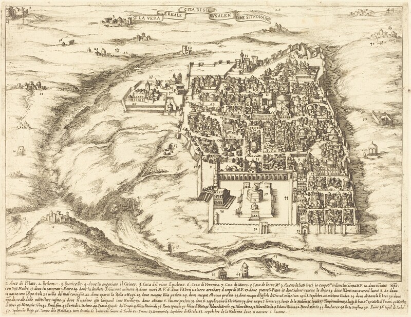
The image shows an aerial view of a historical city map, focusing on Jerusalem. The perspective is elevated, offering a comprehensive view of the cityscape and surrounding areas. The horizon is visible, with faintly drawn additional settlements or structures in the distance. The illustration features detailed linework defining buildings, city walls, and topographical features like hills and valleys. The color palette is monochromatic, mainly sepia tones, giving it an antique appearance. The image depicts the dense clustering of buildings and landmarks within the city walls, with the landscape gently sloping away outside the city towards the horizon, including smaller structures and natural terrain.

Media Options

This object’s media is free and in the public domain. Read our full Open Access policy for images.

Artwork overview

  • Medium

    etching and engraving on laid paper [restrike]

  • Credit Line

    Transferred from The Library of Congress

  • Dimensions

    sheet: 71 × 46.5 cm (27 15/16 × 18 5/16 in.)

  • Accession Number

    1986.50.165

  • Catalogue Raisonné

    Lieure, no. 349, State (restrike)

  • Series Title

    Guide Book to Buildings in the Holy Land: pl.36


Artwork history & notes

Bibliography

1924

  • Lieure, J. Jacques Callot. 5 vols. Paris: Editions de la Gazette des Beaux Arts, 1924-1927. Reprint. 8 vols. New York: Collectors' Editions, 1969.

Wikidata ID

Q74873925

You may be interested in

Loading Results