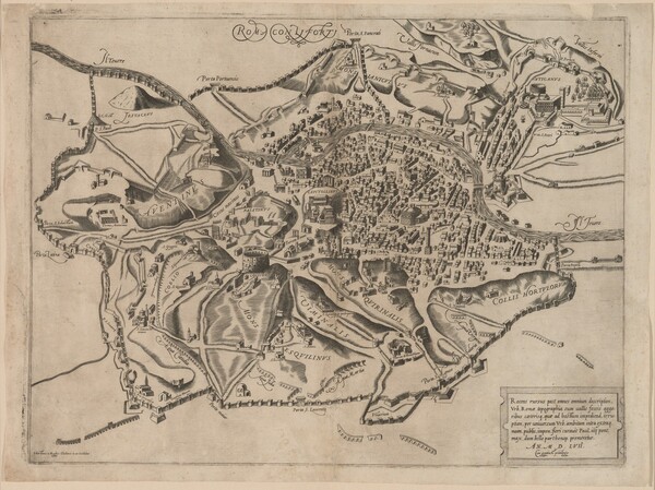
Sebastiano de Re (Italian, 1581‒1613)
Roma con li forti
1557
Sheet Size: 34.8 x 46.5 cm
Etching and engraving
Collection of Fredrika and Paul Jacobs
This map, dated 1557 in a cartouche, shows the new walls built by Pope Paul IV. This impression represents the first state of the plate, before additional text was added for later printings.
The image compare list is empty.
Key to Map Annotations
The annotations (pins, polygons, and other shaded areas) indicate the following information relative to the maps over which they appear. These annotations can be toggled on or off using the "toggle annotations" dialogue box at the top left of the Mirador image viewer.
- Green/Verde: Churches/Chiese or other edifices as they are labeled on the map or noted in the legend on each map
- Blue/Azzurro: Identifiable churches or other edifices unlabeled on the map and unnoted in the legend
- Yellow/Giallo: Palaces/Palazzi
- Purple/Viola: Plazas/Piazze
- Orange/Arancio: Portals/Porte, Roads/Strade, or other